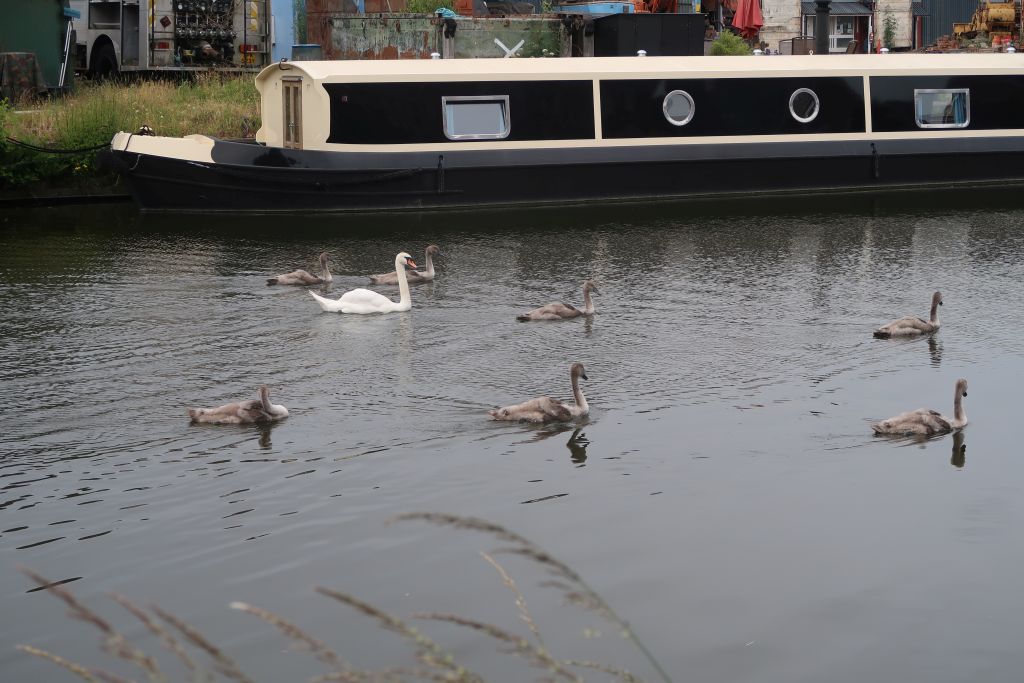
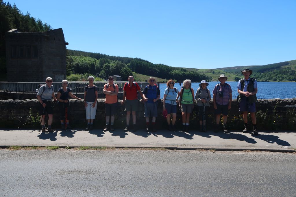
2 Jun 2021 Timbersbrook Leader: John & Doreen, Length of walk: 9.5 miles, Driving Distance: 15 miles, Number walking: 12
Timbersbrook Picnic Area was built on the site of the Silver Springs Bleaching and Dyeing Company which used the pure clean water to bleach and dye rolls of unfinished cloth, mostly from Manchester. In the 19th century a silk mill occupied the site; a map of 1777 showed a water wheel at Timbersbrook which may have powered one of the early silk mills.
Early in the 20th century the mill was converted to steam power which required a 114ft chimney. The mill closed in 1961 and Blaster Bates demolished the chimney in 1966 leaving the closed toilet block standing. Some old residents say the toilets used to be operational but historians dismiss such claims.
The first part of the walk involved the leaders shouting at unsuspecting residents as if they were related. The supply of residents soon ran out as the path went into fields and the cows were reluctant to respond.
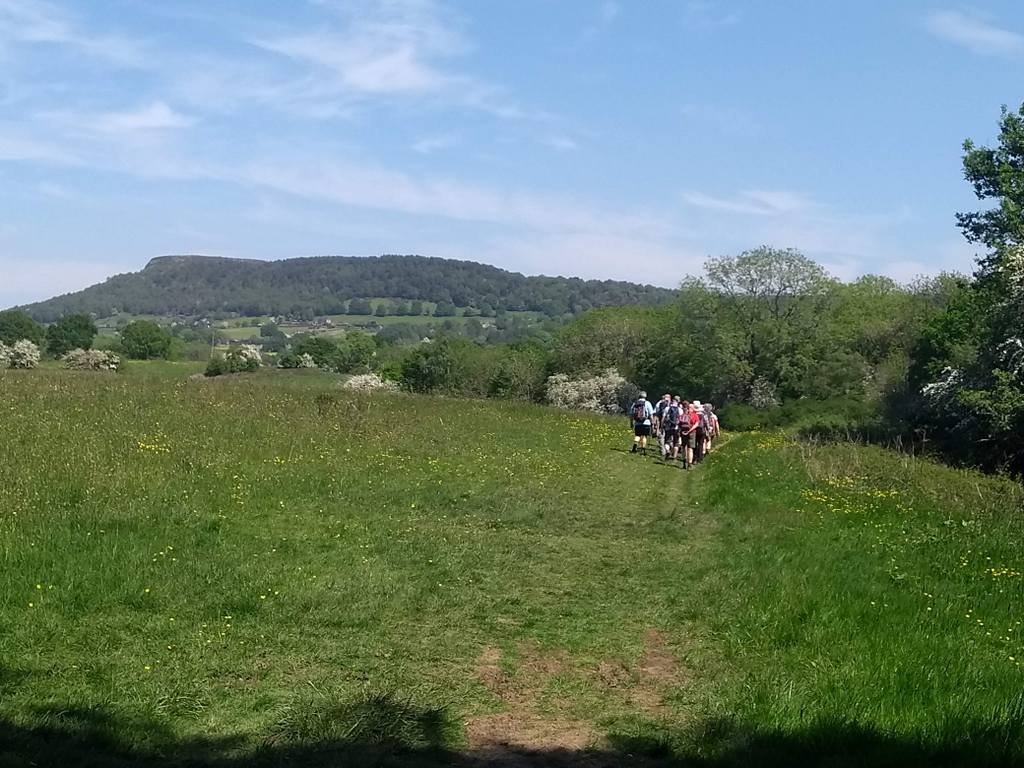
Using the Gritstone Trail and the Biddulph Valley Way the group eventually passed Castle Inn before crossing the road for the climb up to Congleton Edge.
A coffee stop in an open area gave delightful views over the Congleton area before the walk continued south along the ridge through the wooded path which shielded the walkers from the heat of the sun.
The path came down at “Nick I’ th’ Hill”. This feature is a nick in the hill and, obviously someone of a whimsical bent thought spelling it with some letters missing would be more historical as if people from way back were all simple. The path continued up the ridge again with some unfenced precipitous drops right next to it. Nobody screamed or fell off.
When the path met the road towards Mow Cop, the leaders urged caution to avoid being struck by passing vehicles. As time went on and no vehicles passed by, some thought the world had ended without informing walking groups. However the curious lack of traffic was caused by the barriers erected to close the road for some invisible work.
There was some discussion about the correct way to pronounce “Mow Cop” but to prevent an unruly squabble, the leaders turned off toward Biddulph with the cry “It’s all downhill from here”. This didn’t stop Mike demonstrating his ability to spell various random words rhyming with “cow”. He is such a show-off.
Lunch was in a freshly mown field – thank you to the leaders. After lunch the two stalwarts who had managed to stand up from a sitting position without using hands on a walk from Oakamoor in July 2018, tried again. One soon gave up and the other managed it with some cheating.
The route went down to Biddulph and joined the Biddulph Valley Way, which was shared with a variety of walkers and cyclists. The male cyclists didn’t demonstrate a happy disposition; the impression was they were coerced into exercise and resented it.
Where the Macclesfield Canal crossed the old railway track, the group joined the towpath. This prompted Pete to suggest this presented the opportunity for some gongoozling. This is a word he remembered from an episode of “Call My Bluff”. It means standing idly watching boats pass on the canal. It might be presumed that such an expression would date from the nineteenth century, when canals were at their peak, but the word is only recorded from the end of that century or the early twentieth. It was popularised by the late L. T. C. Rolt, who used it in his book about canal life, Narrow Boat, in 1944. You would think that, during a cataclysmic world conflict, people would have more constructive things to do. [For those of you who like to check out the facts from these reports using Google, I urge you NOT to look at the definition of “gongoozling” in the Urban Dictionary website. It is most unseemly.]
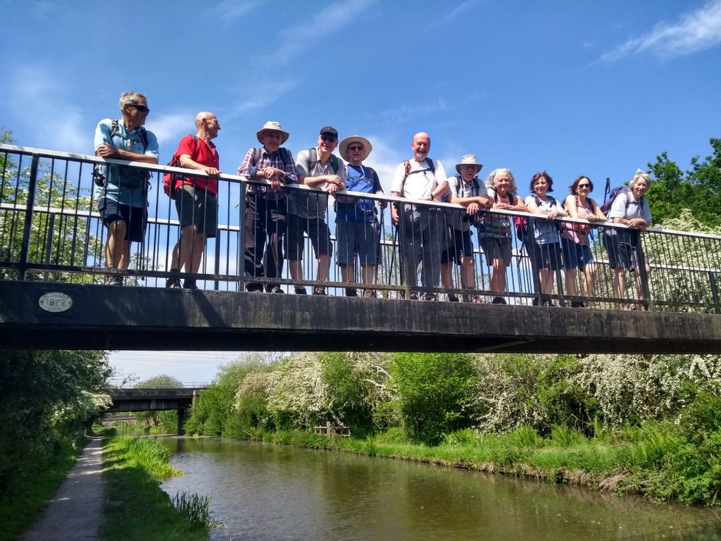
The group left the Macclesfield Canal at a footbridge and, after a traditional bridge shot, went back to Timbersbrook across the fields.

16 Jun 2021 Goyt Valley Leader: Marie, Length of walk: 11 miles, Driving Distance: 23 miles, Number walking: 12
Click on this link to see the map of the walk
It was a sunny day with a cooling breeze most of the time and when the leader offered a choice of the full 11 miles or a shorter version everyone said go for the 11. Who can say how many regrets were uttered the day after. The Derbyshire Bridge car park is named after the nearby bridge over the River Goyt. There are other bridges in Derbyshire; maybe this one was named by someone coming from Cheshire, who didn’t get much further.
The leader was making her first foray into leading a walk for this discerning group and was a little concerned that there might be complaints. Fortunately no walkers of a complaining nature were present.
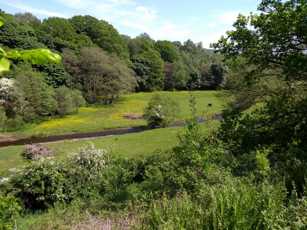
First move of the walk was to climb from the car park to the Cat & Fiddle, now reopened with a distillery attached. On the way the banks of the River Goyt demonstrated the resources that lie beneath the ground and brought people to the area – known as Goyt’s Moss. There are two seams of coal and the river has eroded the ground to reveal the upper seam in places. The area is littered with the remains of the many small pits that were dog to extract it. The coal wasn’t very good but it was good enough for the Duke of Devonshire’s lime kilns at Buxton. He wasn’t living nearby to catch the smoke from its burning. No coal has been dug since 1919 and the houses that sat near Derbyshire Bridge were demolished when the Fernilee dam was built in the 1930s.
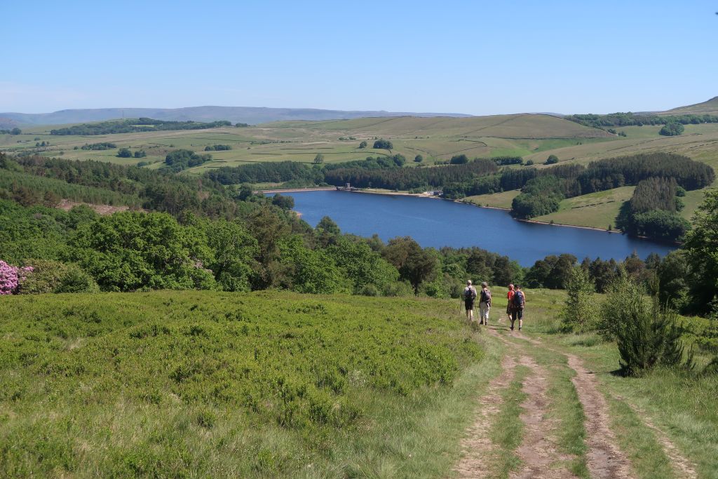
There was no stopping at the Cat & Fiddle; a coffee stop was schedule at the Errwood reservoir. On the way down, newcomers to the area were impressed by the thick woodland in Shooters Clough. This was planted by the Grimshawe family who lived at the now-demolished Errwood Hall – a casualty of the dam building. Some bright spark suggested that the coffee stop might be more comfortable under the shady trees off the path so that’s where the walkers settled down. And that’s where the midges started to get interested. They forced the group to up sticks earlier than intended and left poor Bill still drinking his hot coffee when all the others had left.
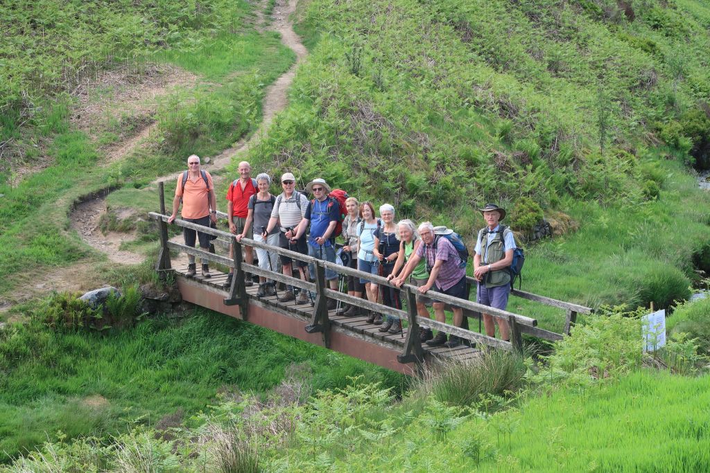
The route went along the side of the Errwood reservoir, opened in 1968, and over the dam to the far side. Ninety years earlier the river crossing would have used this elegant suspension bridge.
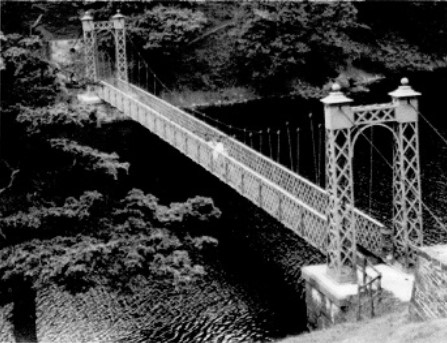
The group posed for a (sort of) bridge picture before climbing up the hillside using a road that was built on the site of the Bunsall incline. On this steep slope was built one of the steep inclines of the Cromford and High Peak Railway. This was a very early railway, opening in 1831, built in very challenging terrain for carrying mineral traffic by people with no experience of operating steam locomotives. The motive power was horses with static steam engines to haul wagons up the steep inclines; their first locomotive arrived in 1841. Given that they expected wagons to go at walking pace, the designers saw no need to make the track straight so they followed the contours of the ground as if the track were a canal. As a result the directors realised after a few years that their company would never be profitable. Nevertheless it continued until it was abandoned in 1892.
At the top of the incline the walkers went cross-country for a while before walking along a level stretch of the old trackway until it reached the blocked-off tunnel to Burbage. This was the site for lunch in the sunshine.
After lunch the walkers had to climb over the wooded hill to Burbage with views of Buxton in the distance. After checking out the area – big houses with horsey features and a few farms, the group climbed up to Burnage Edge to make the journey back to the car park. At the top some thought that the route should be ”all downhill from here”. When the leader was pressed on this question she was non-committal. The group plodded on and eventually spotted the road that runs alongside the River Goyt. This narrow road between Goyt’s Moss and Whaley Bridge was known as “one of the loveliest in Derbyshire”, and was hugely popular with tourists visiting the spa in Buxton.
It was popular with this group as well because they knew it led back to the car park. Unfortunately it led up to the car park but it was good fun turning each corner hoping to see a sign that the journey had ended. That involved quite a few corners and failed hopes.
23 Jun 2021 Northwich Leader: Kevin, Length of walk: 10.5 miles, Driving Distance: 13 miles, Number walking: 15
Click on this link to see the map of the walk
The leader chose the route because it was easy to drive to and included no scary hills. He then realised that various locations along the walk had connections with his family, most of whom lived in the Northwich area for generations. Instead of listening to who built an old house on the route, the walkers had to share in details of the leader’s family history.
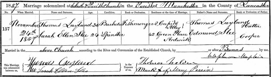
The first heritage factoid was the marriage of Thomas Leyland and Sarah Ellen Slee in 1857 in Manchester Cathedral. Thomas ran a fishmonger shop in Witton Street and Sarah’s father had a cooperage business nearby. At the time of the wedding they both lived in Manchester – Thomas in the dubiously named Cupid’s Alley off Deansgate. It is now renamed Atkinson Street.
As the group walked down Meadow Street, the leader stated that grandfather Roly Dean was born in a house in that street, although all the dwellings there were demolished decades ago.
As the walkers passed the church, the leader made them climb a hill to the road to avoid a blockage in the path where part of the churchyard wall had collapsed. This was the steepest hill of the walk although it was only about six yards long.
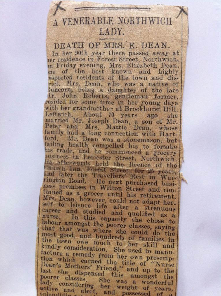
At the corner of Kingsway and the dual carriageway, the group heard about Elizabeth Dean who died in 1924 in Forest Street, which was replaced by the dual carriageway. Elizabeth was the grandmother of the aforementioned Roly Dean and after her husband retired from the pub trade, she trained as a nurse and peddled a tonic for poor mothers of the area. It is difficult to avoid the assumption that the potion contained mainly gin.
Outside number 26 Kingsway the group heard how the leader bought his first house in 1969 for £2,250 and sold it five years later for £8,500.
In Greenall Road the mood went darker as the leader told about the death of his wife’s grandfather’s first wife Jane in 1909 and their two children Samuel and Alice in 1897. A year later grandfather married Jane’s cousin, whose parents had both died recently at the age of 34. Genealogy can be grim.
Although Aunty Beryl’s nearby house was not visible from the footbridge over the railway, the leader told of the time her Alsatian dog crashed through the glass front door to attack the postman. The fate of the postman was unknown. Maybe that features as the grim news in somebody else’s family history.
After crossing another footbridge over the railway line to Sandbach, the group passed through an apparently deserted estate to reach the path alongside the river Dane. This is where the group met luxuriant vegetation, where nettles lurked in the long grass to confound those wearing shorts.
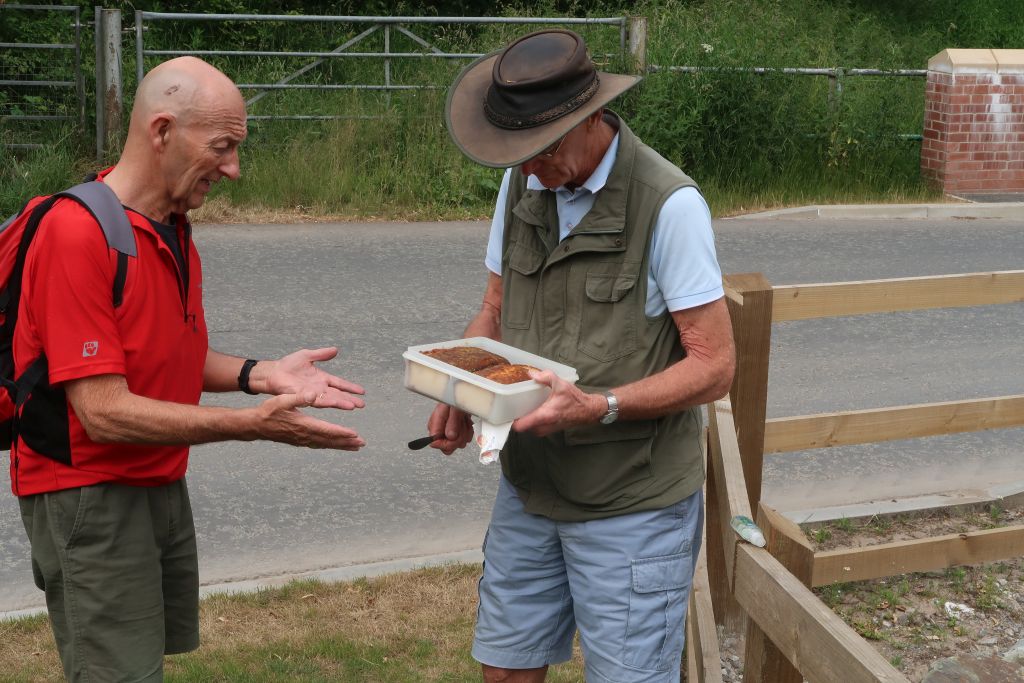
When the walkers escaped the vegetation, they were obliged to eat the leader’s lemon drizzle cake on a patch of grass in Shipbrook Road.
The route then took the group along Gadbrook Road so that the leader could point to West Avenue, where his mother and wife were both born. He stressed that the families were not connected before his marriage.
After being thwarted from entering a tunnel in the Goyt valley, the walkers were excited to take the tunnel under the A556 to reach Roberts bakery. Sadly the cooling towers which normally display loaves riding down a spiral conveyor was stationary.
The next heritage point centred on a large bungalow with a billiard room. Neither the leader nor any member of his family ever lived there and he never entered the property, but he did consider buying it until he realised how exposed the site was to rampaging axe-murderers.
After spending some time in the convenient woods by the bungalow, the group met further thick vegetation before crossing the railway line to Sandbach again and leaving the road to cross a large field. The leader had arranged for the field to be mowed; in fact the mower was still working the field next to it.
On the last recce the leader had encountered a group of cows with calves in the next field, so was pleased to see that the field was empty. However, after a few paces into the field it became obvious that the cows and calves had moved to park themselves en masse on the part of the path down by the river that was fairly dry. The leader took a diversion through the reeds where the muddy water underfoot made its mark on the walkers. Some took this as a badge of honour to show that they done some serious walking.
The route crossed the river Dane over Shipbrook Bridge, where the party paused for a picture. The leader pointed out Shipbrook Hill Farm that marks the site of Shipbrook Castle. The Vernon family built the castle in Norman times and the last ruins of it were swept away in the late 18th century.
As the walkers climbed up to Davenham they found more cows and calves, but this group was more obliging and kept away from the path. The group was warned to beware of dogs as they crossed the yard of New Hall Farm, but it was a day for moving cattle out so the dogs were absent.
Outside a house in London Road the leader helpfully pointed out that he had considered asking the resident, his wife’s cousin Alan, if the group could stop and lunch in the outbuildings and use the outside toilet. Covid-19 scuppered that plan, so the group never got to see Alan’s extensive collection of tractors.
As the leader strode confidently away from Davenham, he had a gradual realisation that he had no idea where he should turn off the path. Tracking back from the unfamiliar terrain, he led the group back to the path towards the river Weaver.
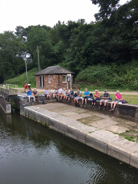
At last the group reached Vale Royal locks at 2pm, where the weary walkers sat down to enjoy lunch.
The walk back along the river followed part of the Weaver Way which forms a path between Audlem and Frodsham. Along the way the leader indicated the invisible Sir John Deane’s Sixth Form College, which he attended when it was a grammar school.
As the group migrated from the river Weaver to the river Dane, it passed Chapel Court apartments built on the site of the Methodist chapel where the leader’s parents were allegedly married in 1945. The only picture of the event shows two people who are impossible to recognize. The leader also boasted that the railway arches which lie alongside the path were built by his great great-grandfather Joseph Dean, a stone mason and husband of Nurse Elizabeth (see above). He did have help.
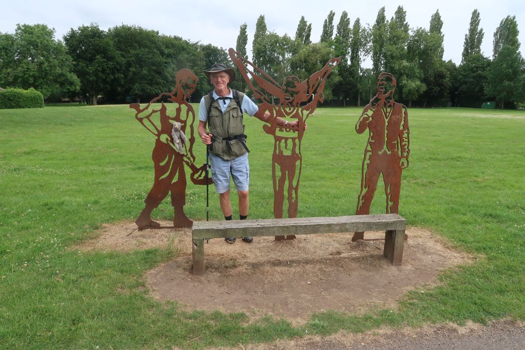
Walking along the river Dane, the walkers passed a representation in steel of Northwich legends and on the other side of the river was the site of the Drill Field, where Northwich Victoria FC used to play. Roly Dean appeared for them in the early 20th century and, according to his son, was the “dirtiest left half in the Cheshire League”. In the full report of Elizabeth Dean’s funeral (see above), Roly was described as “the popular ex-Northwich Victoria footballer”. Maybe his excesses on the field were ignored on this occasion. In the same report Roly’s father was described as “a popular local entertainer and charity worker”. I wonder which one of them supplied the report to the Northwich Guardian.
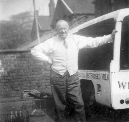
The final heritage site lay in the shadow of the ASDA store, where a fenced-off wasteland marked the site of Roly’s milk delivery business after it moved from the grounds of his house in Winnington.