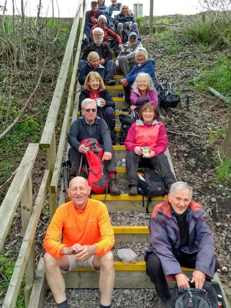
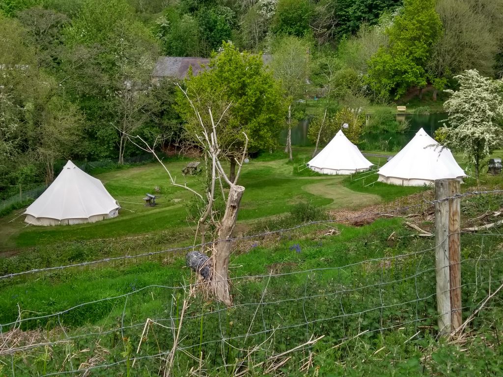
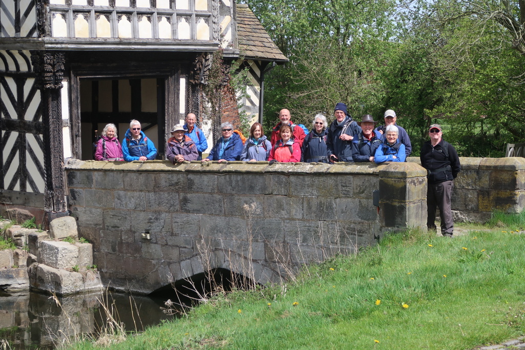
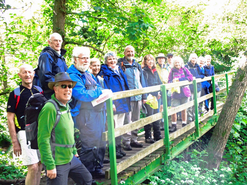
5 May 2021 Astbury Mere Country Park Leader: Stephen, Length of walk: 11 miles, Driving Distance: 7 miles, Number walking: 15
The leader was in charge of the walk to Mow Cop last December which was cut short by heavy rain. This was such a disaster that the survivors described it as like “Gorillas in the Mist”. The leader hoped that by May the weather would have improved so that the part of the walk that had to be abandoned could be completed in pleasant circumstances. The weather had not improved; it was not pleasant; the walkers were assailed by cold, rain and hail. Sometimes, as if to show what they could have had, the walkers also saw glimpses of sunshine. The one walker who turned up in shorts also had the foresight to don woolly hat, gloves and a waterproof coat.
The walkers set off in overcast conditions to walk clockwise round Astbury Mere and then climbed to an area of new house building before reaching the Macclesfield Canal by Astbury golf course. As they tramped along the canal they were passed twice by a kayaker who failed to respond to a cheery greeting. Hardly surprising given that he was sitting in cold water being battered by hail and rain.
A toilet stop was called at the appropriately named Watery Lane aqueduct but the cover from users of Watery Lane is minimal. This shows what a brazen lot these walkers are.
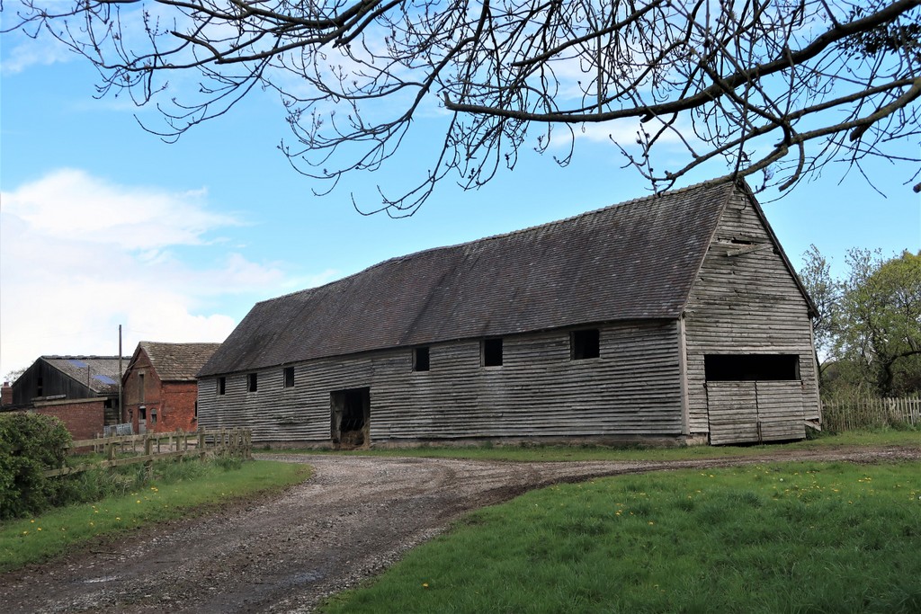
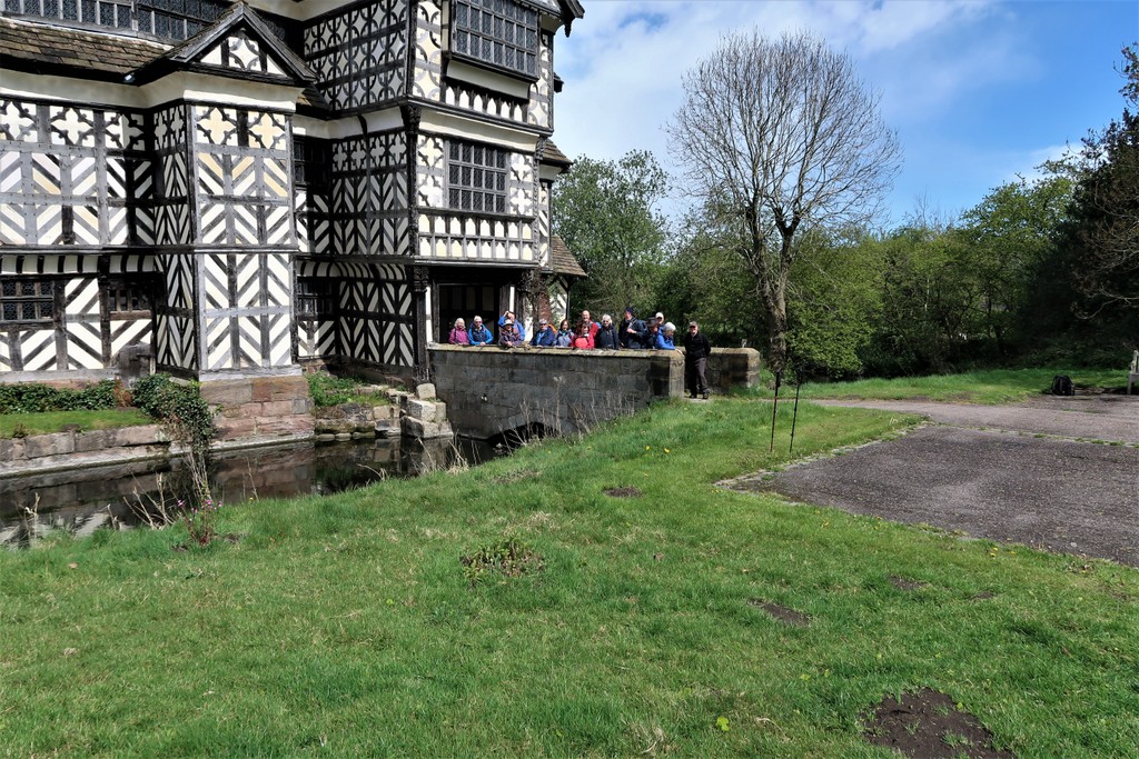
The group left the canal for Little Moreton Hall which was the site chosen for the lunch stop.
Just before the iconic hall, the group passed the large barn at Little Moreton Hall Farm. The Historic England website claims this is of 15th century origin but states that the roof tiles, clapboard sides and stone plinth they sit on are all 20th century replacements. Unlike Trigger’s brush there may be components from the 15th century but they are not visible from outside viz. the internal frame beams.
Some barns used to be tithe barns, which were usually associated with a church unlike the barn at Little Moreton Hall Farm. The tithes collected from the local people to support the church officials were kept in the tithe barn. The English Heritage website says “not one of England’s surviving architecturally impressive barns was a tithe barn, although such barns existed”
The weather over the lunch stop was kind, so no sandwiches went soggy on account of rain. However, the National Trust staff at the entrance were not so kind; they refused permission for the ladies to use the toilets.
The group crossed the A34 to Cuttleford Farm Shop where they bypassed the commercial delights and followed a path on the edge of the farm. This so enraged the resident hound that it barked vigorously as the walkers went by. Encouraged by shouts of “He’s at the back!” the dog made its approach as the back marker passed it. Fortunately the back marker was ready with walking pole deployed and the dog retreated, not relishing the prospect of cold steel in its mouth. The result: Gallant Back Marker 1 Forces of Evil (Canine Division) 0.
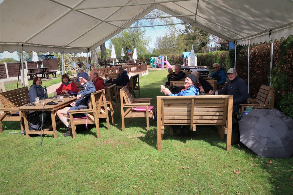
After more wandering through hail-splattered countryside, the group reached the Blue Bell Inn where a marquee in the garden offered sunshine, seating and hot drinks with a toilet stop inside for mask wearers.
The next part of the route passed Bent Farm quarry, which is deemed so dangerous that it is surrounded by two hedges and a barbed wire fence covered in warning notices. Nobody fell in.
Reaching Congleton by Padgbury Lane, some wondered about the derivation of the name. Fortunately the English Place-Name Society website has covered the case and provides the following suggestions:
Early references were to Padgebridge in 1626, Padgbridge Lane in 1593 and Padgebury Lane in 1831. The origin of this name is perhaps ‘pads bridge’, from the dialect word pad ‘ a path ‘. The plural pads is used in north-west Lancashire to denote a continuous line of footpaths across country , and the same usage may have held for south-east Cheshire ; but the name could also be ‘patch of ground newly broken in’.
So there you are.
Crossing the A34 again back to Astbury Mere the group passed the sign for the Nobanno Indian restaurant. This name derives from the Bengali word “Nabanna” (literally new feast) meaning a festival at the time of harvest. Anybody who grew up attending a Methodist harvest festival will know what the Bengalis get up to at Nabanna.
19 May 2021 Winterley Pool Leader: Kath & Elaine, Length of walk: 8.5 miles, Driving Distance: 2 miles, Number walking: 15
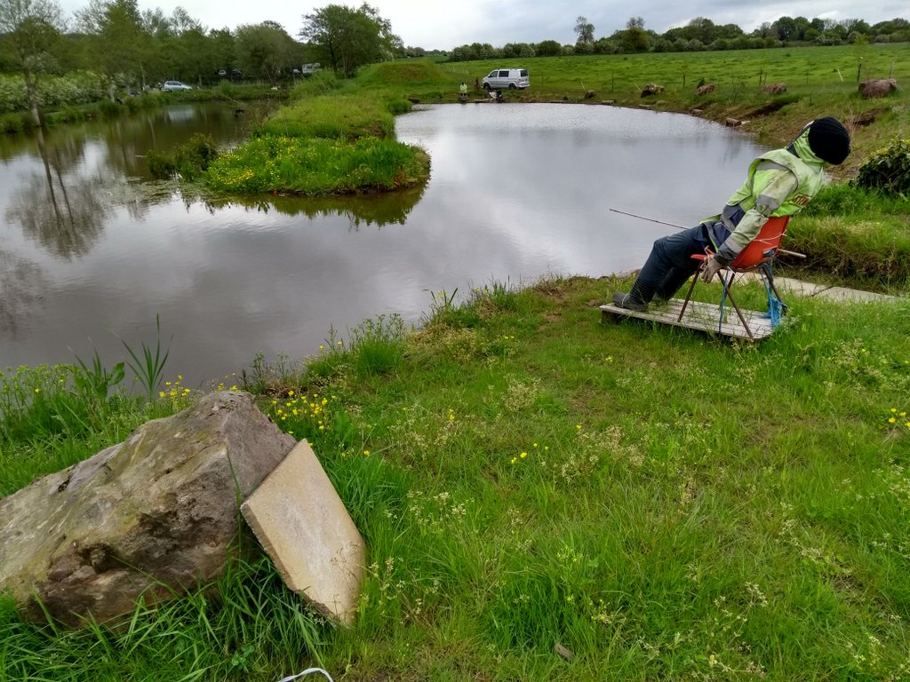
The first record of Winterley Pool dates from 1769. It was built to provide a reservoir of water to power a corn mill which stopped working in 1926. The dam that holds back the water was also built as a turnpike road – two for the price of one – and the road is now free to use! The source of the water is Fowle Brook, which starts in the nearby fields of Oakhanger, so it doesn’t have much chance to build up a head of steam on the way. This is the reason why the pool is so large for just one mill. In an echo of today’s concern about the intermittency of wind and solar power, the owners added a wind powered mill before 1816 and a steam engine in the 1890s. It now provides a haven for birds and a car park for walkers.
The group set off past the outflow and turned off the main road to venture onto the flat fields in the warm sunshine. The sun did its usual thing of coming and going so that the group had to stop to don or doff layers as appropriate. This was of particular concern on arrival at Crewe Golf Club, where a shower of hail obliged the use of waterproof layers. The group was able to walk across the course without being hit by golf balls and, as usual, exchanged cheery greetings with the friendly golfers, who are always pleased to see walkers crossing their path.
Before reaching the road to Barthomley, the bridge over Valley Brook offered the chance of a picture so Barrie stepped in to take it. The picture would have been so much better if he had followed the advice of walking along the fallen tree to a position directly over the brook.
A wood by the railway bridge on Barthomley Road provided the site for a coffee stop and a discussion about a curious pipe emerging from the ground. A strongly expressed view was that the pipe was a vent for methane emitted from the tip that supposedly lay under the trees. With no other evidence proving that the pipe vented methane or that the trees had been planted on a closed tip, the methane hypothesis is shaky. The Sandbach U3A Waste Excavation group may need to be called in (once the group has been formed).
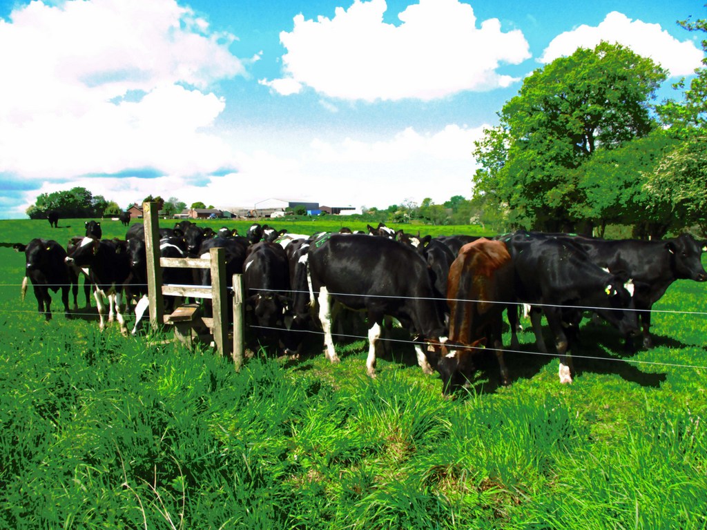
A pleasant stroll along the road towards Top End Farm was spoilt by the pack of 5 dogs that emerged barking fiercely. With hackles raised to show they meant business, they kept up a terrifying vocal assault which ceased only when they were called into the farm. The path round the farm passed a large water tank containing a massive rat floating and decaying. To make the farm even more memorable, the path then passed through a field containing a herd of bullocks lined up against the electric fence in anticipation. Also in the field were FOUR bulls all sporting shiny nose rings and as the walkers tried to reach the end of the fence to reach the stile, they all followed. The beasts enjoyed the intimidation until the group had passed through and then wandered off as the walkers regained their composure.
The next hazard was the level crossing giving access to Oakhanger over the railway. This was uneventful in the absence of any rail traffic and led to the church of St Luke, which serves both the Anglican and Methodist congregations of the Oakhanger area. The biggest feature of Oakhanger is Oakhanger Moss, a raised peat bog with plentiful trees, which the group walked round to reach the lunch stop in a field provided with logs for impromptu seating.
After lunch the route passed through Oakhanger Hall (a big farm) and then meandered through various fields until it reached the point in Winterley, where the group originally left Crewe Road.
26 May 2021 Mouldsworth Leaders: Mike & Linda, Length of walk: 9 miles, Driving Distance: 22 miles, Number walking: 16
Click on this link to see the route on a map.
The last visit to the Goshawk was in March 2019, when the sun shone and the wind was absent. This time the sun was mostly absent with a few welcome appearances but the wind wasn’t a problem. Check the report of the last walk on the U3A website. Some of the walk covered the same ground and it’s always good to review some well-constructed prose.
The route from the Goshawk followed the road to Ashton Hayes, which still has a sign indicating their aspiration to become a carbon-neutral village. By 2018 they had reduced their carbon footprint by 40% – well done! They haven’t reported any progress since though – hmmm.
After leaving the road, the group followed the Baker Way parallel to the unseen Ashton Brook up to Peel Hall. Baker Way is nothing to do with the nearby mill. It commemorates Jack Baker, who was footpaths officer for Cheshire County Council. Peel Hall is a large house on a hill that was built in 1637 by the delightfully named Henry Hardware. It was built with 42 hearths but the dustbin was too small for all that ash so they were reduced to 17 at the start of the 19th century. The entire building was then reduced in size and result looks odd today with hardly any windows on a large expanse of wall. It also failed to impress George Ormerod – renowned historian of Cheshire, who described it as “an indifferent specimen”. The property had a large number of horses around it but the route took the walkers off for some serious mud walking.
At Swinfordmill Farm the group joined the Longster Way (see Mar 2019 report for naming) which led to the perilous crossing of the railway line. Before the crossing the group enjoyed a coffee stop on the step leading up to the track. Stephen started to filch some of the stones keeping the embankment in place, claiming that they were “pretty”. After some contrary views he was persuaded to leave the embankment in place.
A farm close to the path had warning signs informing that dogs were loose and, sure enough, one started barking at the group. When the back marker showed up with sharpened walking pole deployed for attack, the dog turned and smartly retreated. It looked just like the offensive dog on the Winterley walk.
The next hazard was a gate in the middle of a large puddle. The workaround was scrabbling under a barbed wire fence but everyone passed through without injury. A bit of road walking followed until the route passed Manley Old Hall fishery. This collection of ponds has various mannequins round the edge to keep away cormorants according to a local who was interrogated on this matter. The Old Hall itself followed with its well-cultivated garden and pond.
At this point a dispute arose in the leadership team as to the best route forward. Linda thought the field route best and Mike favoured the road. As a result the walkers strode through a swamp masquerading as a field until they reached a tarmac path and then turned round and walked back to the road they were on before the swamp. Looking at the v-shaped route on the map, it is difficult to see the value of the detour, but the leader (at least one of them) knows best.
Lunch could be delayed no longer, but with a shortage of suitable sites, the leaders stopped at a junction under a fingerpost. This allowed the group’s picnicking arrangements to be gazed at by all the passing motorists.
Before the group left the picnic spot, the back marker asked them to make sure that they had picked up all their equipment. As a digression it is worth pointing out that if anyone making such an announcement had left his mat behind, this could lead to ribald laughter and embarrassment. Obviously that would not happen in a well-run group like Sandbach U3A, but it is a point worth making.
The route then followed the Sandstone Trail past a field with picnic tables, which would have provided an ideal spot for lunch, if only the group was prepared to pay for the privilege. The leaders obviously thought the walkers were too tight for that.
From Manley Common the route went downhill to Ashton Brook for a bridge picture and up again to Brines’s Brow Picnic Site which seems to have been abandoned. On the way a genteel rebellion took place obliging the leaders to deviate to a designated picnic area without any facilities. Mike insisted he had no choice in the face of stern rebels Stephen and Pete but some thought the pub was a better attraction.
In a field next to a campsite the lettering on the pub wall became visible and heartened the group for the last uphill section and a drink by the bowling green.
From time to time on the walk, the back marker stepped forward taking on Graham’s previous role as chief opener of gates. Some training is required for the younger element.