
3 Dec 25 Rushton Spencer to Rudyard Leaders: Lesley, Length of walk: 8.75 miles, Driving Distance: 15 miles, Number walking:12
Click here to see the route
This walk will take us from the public car park alongside the Knot Inn at Rushton Spencer. We will then walk to the top of Rudyard Lake and will take the paths over to Horton village. After this we drop down to the lake and then walk alongside it until we reach the pub where some of us may want to stop for some refreshments. I will warn you that I walked this a while ago and so I’m not sure of the state of the paths but I think there will be mud!!!
17 Dec 25 Rode Heath, Betchton, Hassall Leader: Simon, Length of walk: 8.5 miles, Driving Distance: 5 miles, Number walking: 16
Parking at the Wilbraham Arms, Alsager ST7 2AX
Click here to see the route
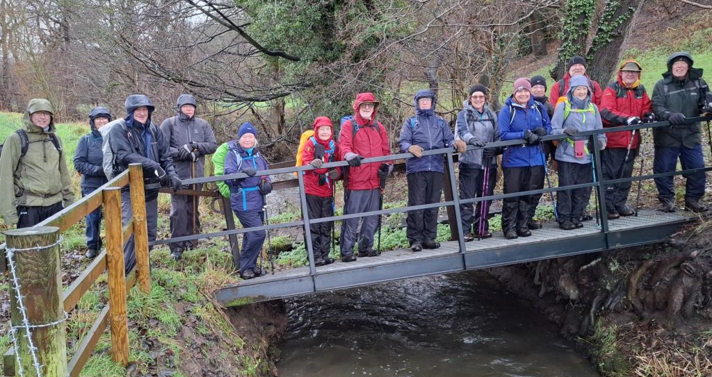
The dominant weather feature of the walk was rain. It had set in at the start of the walk and continued throughout the morning. It did ease off in the afternoon, but the rain of previous showers was ever-present. There was mud underfoot, ponds in fields that should have been green and streams running full. Despite all this, nobody fell over and everyone seemed to enjoy their outing. It obviously helped that the newly refurbished Wilbraham Arms welcomed the walkers after they removed their boots and sodden gear.
After leaving the pub car park, the walkers set off along the dismantled railway track towards Alsager and then went north on the A50. The motorists passing in their dry vehicles did not toot their horns or splash the walkers by driving through puddles. They were probably puzzled to see this compact group striding out in the rain and they would have been unable to see through the waterproof gear how aged the walkers were. The traffic was left behind when the group joined the Trent and Mersey canal at Snapes Aqueduct. The coffee stop coincided with the route leaving the towpath via a bridge to the A533. The leader broke out the flapjacks he had made earlier and issued them to the walkers who didn’t object to fruit in cake. He had added a layer of mincemeat to bring a touch of Christmas festivity to the proceedings.
After enjoying this delight the walkers crossed the A533 and followed the path east along the flooded valley to the A50. After a very short trek north along this road the route turned to the west across more fields and followed a substantial brook. This is a quiet, out of the way place and the mapmakers of the Ordnance Survey failed to name this brook, even on the 19th century maps. It surely deserves better.
The route left the anonymous watercourse to join Love Lane near Betchton House for a while going north but soon left the road to enter the field selected for lunch. The site was well-chosen; it was high above the valley of the brook and provided a bank to sit on. Some walkers were happy to sit on the wet grass but other felt that eating in a standing position was better suited to the conditions.
The next challenge for the group was walking safely along the side of the A533. They all managed it, but you would not recommend it for an old person. They crossed the road and went into a field next to Yvette Fielding’s house. She didn’t come out to give us a Blue Peter Oldies badge or a cheery wave and, given that the house is for sale, she may even have moved away.
Next to the house is a footbridge over the brook adjacent to a ford. The water was so deep at this point that the AA would surely warn against trying to drive through it. The track to which the ford belongs came out on the edge of Hassall Green and the walkers took advantage of the pavement to cross the canal and turn off the road before the pink church. This has been recently painted but only at the front and walkers passing the side see that some TLC is needed there.
The group soon joined the Salt Line way to take them back to the Wilbraham Arms, which was happy to welcome the walkers and the non-walking members of the group who came to join the merriment.