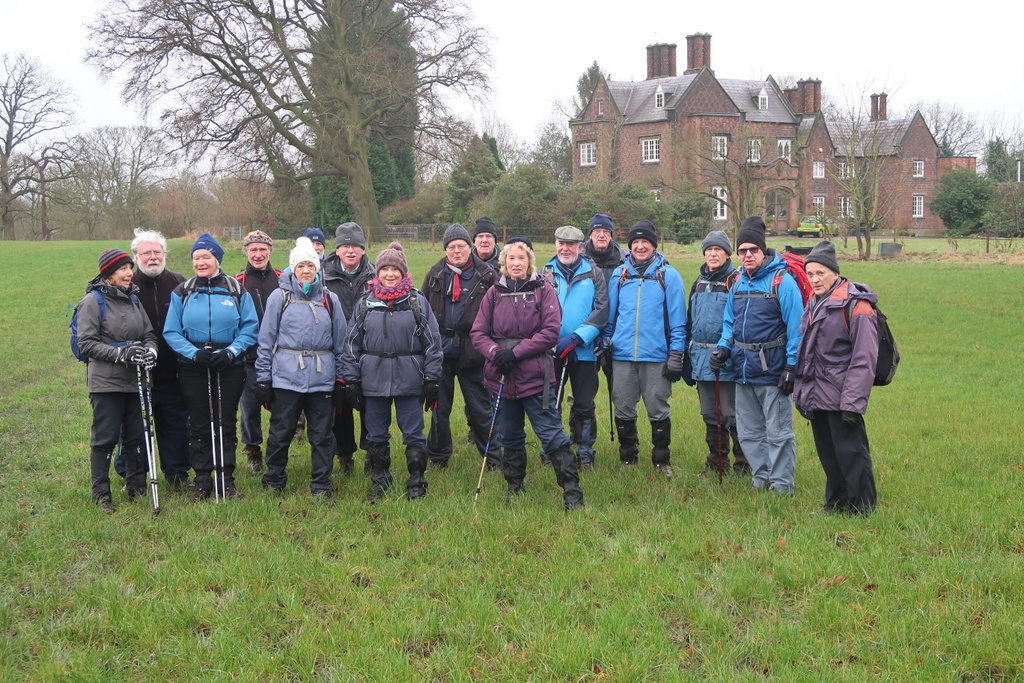
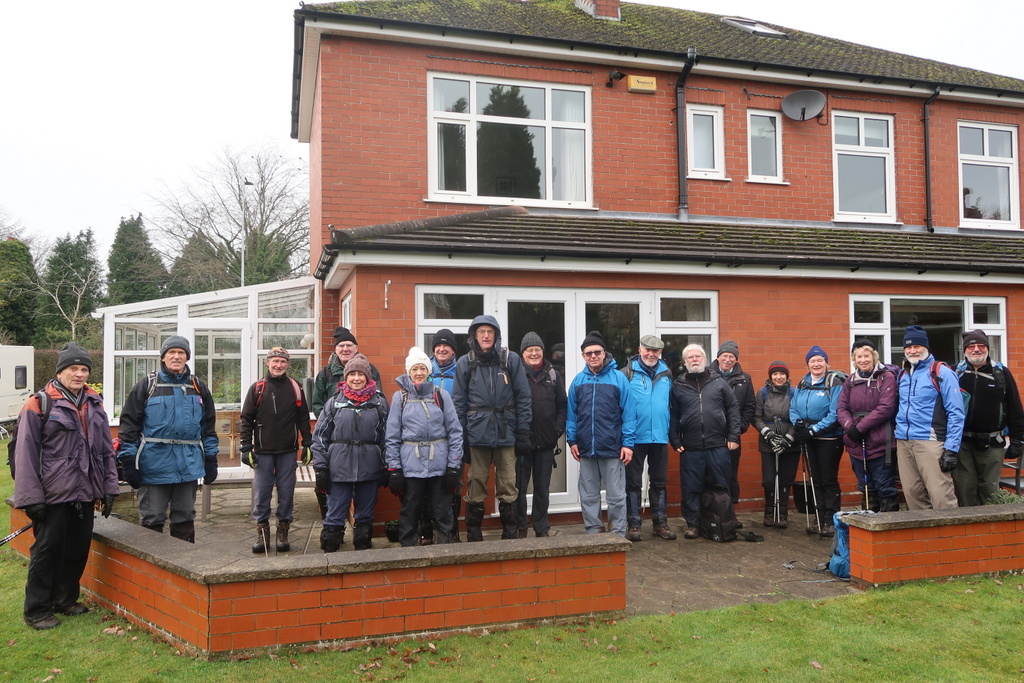
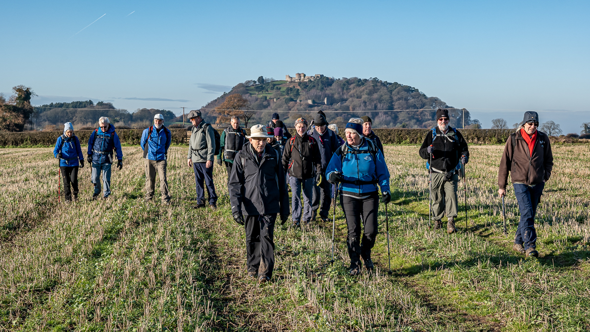
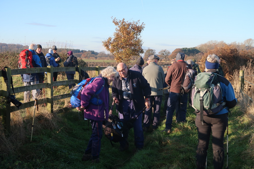
4 Dec 2019 Bunbury Leader: Bill & Ruth, Length of walk: 9 miles, Driving Distance: 20 miles, Number walking: 20
Click on this link to see the route on a map.
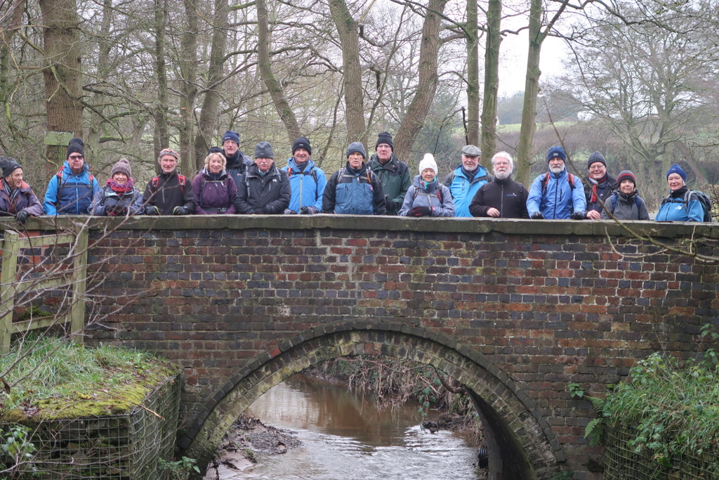
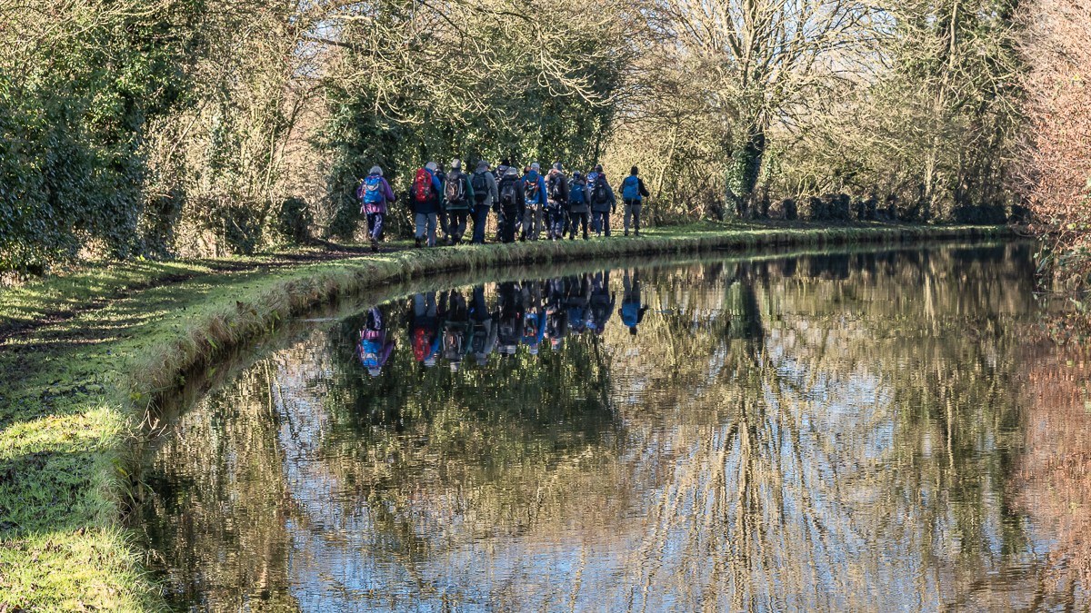
A side road by Bunbury church provided a suitable parking place and the group then set off in the low-lying sunshine to the canal at Bunbury Locks. Beside the canal sits the building previously used as stables for the fly-boats that ran on the Shropshire Union canal. These were the express carriers of the canal era that ran 24 hours a day to provide a scheduled service. The Shroppie Fly pub at Audlem carries on the name.
The leader pointed out a couple of brick structures without windows that sit by the canal and advised that they were huts for the lengthsmen who looked after maintenance of a specific length of the canal. He didn’t explain:
- Why the buildings are round and,
- Why other canals in the area don’t have equivalent structures either round or of more conventional construction.
A job the lengthsman didn’t have to handle was clearing foam from the canal. One of the lock gates caught some of this and mirrored a recent larger outbreak of such foam at a beach in India. This was blamed on pollution in sewage and children were pictured running in and out of it. None of the walkers were tempted to repeat the practice in the canal.
The lock at Beeston was built of cast iron instead of the usual stone. This is estimated to save 90% of the weight and was necessary to avoid the structure sinking in unstable ground. It is both a grade II* listed structure and a scheduled ancient monument, and is unique in England.
The canal section of the walk ended at Wharton’s Lock in sight of Beeston Castle. After passing under the railway line to Chester, the group passed a small group of photographers waiting with cameras poised for a railway event. Martyn went to investigate and discovered that they awaited the imminent arrival of a train consisting of carriages so old that passengers pay high prices to ride in them. The carriages are often hauled by steam locomotives but this train had to manage with two diesel locos. The cameramen in the group decided not to halt the walk to wait for it but the delay would have been small as it appeared soon afterwards.
As the group passed Castlegate Farm a dog made an assault on the back markers but was repelled by defensive walking poles.
As the group left the castle entrance behind, two ladies climbed into a Bentley parked by the cafe. This was obviously a special car because it bore the registration mark 1900 TU. As motoring enthusiasts will be well aware this mark has been used for decades by the Rolls Royce and latterly the Bentley press office for marketing their vehicles. Fans of these cars that are not lucky enough to live in Cheshire ask over the internet if the letters TU stand for “The Ultimate” and are quite disappointed to learn that they were standard issue for cars registered at Chester in olden days.
Just before lunch the path went through an expensive looking garden where a gardener was blowing leaves around. Doreen fluttered her eyelashes at the servant seeking information about the identity and wealth of the owners but the gardener gave nothing away, save that his employer was very good to him. Doreen will have to try alternative techniques for obtaining intelligence.
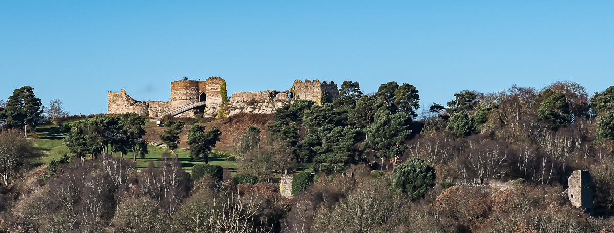
Lunch was by the side of a green lane with no provision for seating but did have views of Beeston and Peckforton castles. Beeston is a proper medieval castle built on the site of a Bronze Age hill fort. Various Bronze Age artefacts have been found there but no lurs*. The castle was besieged by Parliamentary forces in the Civil War and then slighted to remove the possibility of further use as a military strongpoint.
The landowner John Tollemache (pronounced “tol mash”) bought the Peckforton estate in 1840 and had Peckforton castle built as a Gothic mansion. Beeston’s ruins were an integral part of Peckforton’s landscape and were intended to provide a ‘view’ and talking point for Tollemache and his guests. The present castle ticket office and the stone wall around the base of the crag were built in 1846. The wall also acted as a boundary for the deer and the kangaroos that were, somewhat surprisingly, kept on the site.
As the group neared Spurstow they passed a farm which sported some topiary that was obviously intended to be a horse and jockey. Some observers saw a squirrel and other saw a dog on a horse. Topiary is an unforgiving craft.
A paddock on the edge of Bunbury held a tiny horse the size of a sheep and the usual horse lovers assembled to pat it to see if would take a chunk out of their fingers. Ralph found his chocolate and gave a piece to the horse which eventually decided to eat it. The delay meant the main group left the back markers at a T junction with no obvious way to regain the correct route. The back markers deployed their giant intellects and eventually found the main body.
They were then able to climb up to Bunbury church next to the Dysart Arms pub. The Tollemache family included the earldom of Dysart in their collection of titles
The title Earl of Dysart was created in 1643 for William Murray, who had been a lifelong friend of King Charles I, in fact having been his whipping boy.
A whipping boy was educated alongside a prince and received corporal punishment for the prince’s transgressions in his presence. The prince was not punished himself for obvious reasons; seeing a friend punished would provide an equivalent motivation not to repeat the offence. That was the theory but may well explain the behavioural difficulties faced by members of the royal family from time to time.
Wikipedia is the gift that keeps on giving. It is well worth paying to keep it going and it provided this delightful passage about the first Earl of Dysart “Murray was succeeded by his daughter, Elizabeth, the second Countess. In 1670 she resigned the peerage and received a new grant thereof by patent with precedency of her father, and with remainder to her heirs of the body, failing which to her heirs whatsoever.” This is the English language Jim, but not as we know it.
*LUR a Bronze Age trumpet [3 letter Scrabble word]. Fans of Lurpak butter will see a picture of a lur on the packaging.


18 Dec 2019 Sandbach to Winterley Leader: Tom, Length of walk: 11.5 miles, Driving Distance: 0 miles, Number walking: 18
Click on this link to see the route on a map.
Starting the walk from the Waitrose car park avoids any travel problems due to ice on the roads. The previous day had been colder but for this walk the ground had melted a little and mud was a recurring theme throughout the day. The air was cold but the rain stayed away until after the walk ended.
The heavy traffic on the road to the M6 forced the group to march to the traffic lights at the bottom of the high street and then onto the footpath that goes through Fields Farm, where Willis’s base their drainage company. After crossing Hassall Road the route passed Vicarage Farm, where the builders renovating the derelict farm buildings amused themselves around a bonfire of surplus timber. This aroused envy in the hearts of the walkers who own wood-burning stoves but no one had space in their rucksack for firewood (no Wenceslas in the party). As Bill took the traditional picture of the group in front of the house called Tall Chimneys, Tom informed everyone that although it is now divided into flats, the building used to be the vicarage for St Mary’s in Sandbach.
The path went down the slippery path past Tall Chimneys to the brook where Tom nearly had a soaking 4 years ago. The work that had churned up the ground in 2015 has now finished and the group was able to pose on the bridge where Stannerhouse Lane crosses the brook. Don’t be confused by the name “lane”; this not a road where you want to drive anything other than a tractor.
After walking along the brook the party climbed out to cross the M6 and visit the hamlet of Hassall Green. The houses seems to have planted at random by the canal; the Romping Donkey pub, the canalside shop and restaurant have all been converted to dwellings. One of the council houses did have a Bentley parked outside. Who knows what goes on in these isolated places?
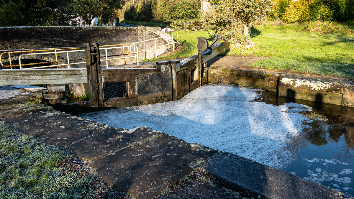
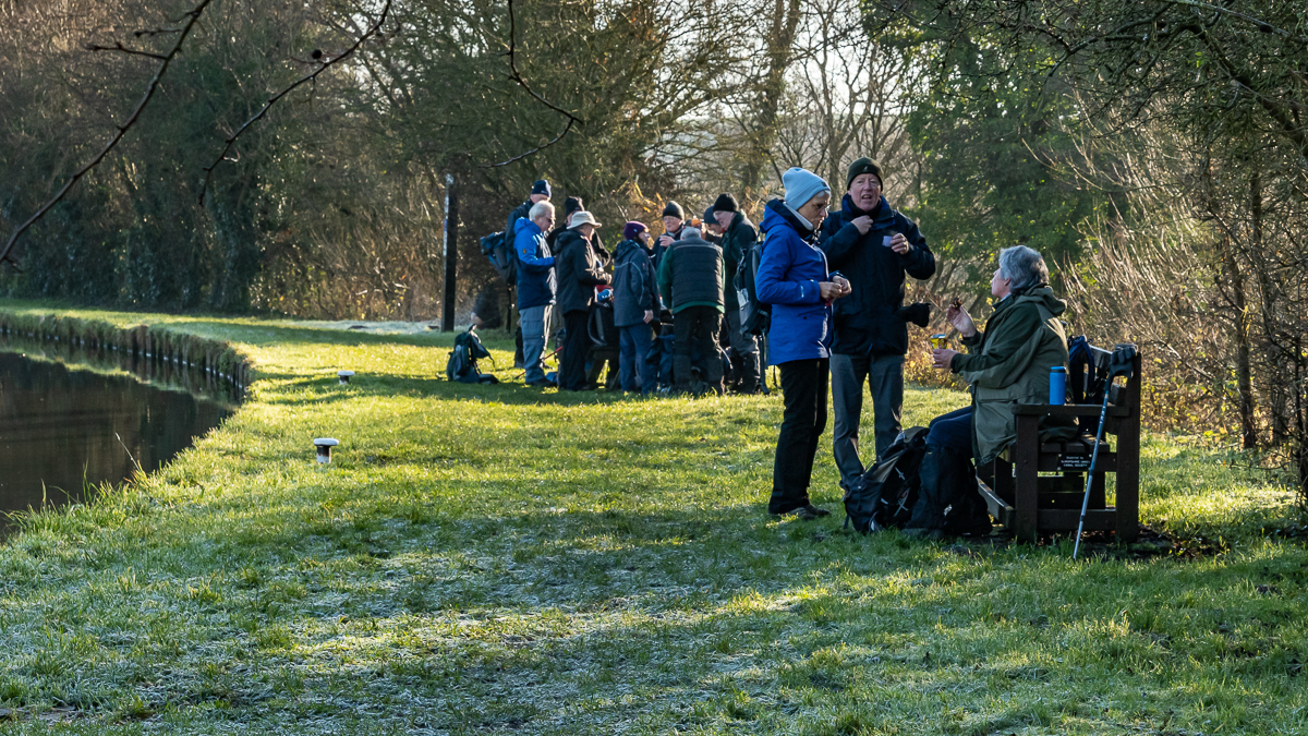
Lock 57 was the site of the refreshment stop, which was fairly brief because of the cold. As the party set off westward along the canal, Mike was lucky not to fall in the water after heading the low bridge. There was a warning sign so no claim.
The party passed Trevor Boxer and his footpath group walkers striding out and throughout the walk his efforts to replace stiles with kissing gates gained praise. Stephen was so excited by one of them that he climbed over it but that is unorthodox.
The route crossed Malkin’s Bank golf course and fields to reach Winterley by the pool and then to Tom’s house for lunch. Lesley provided mulled wine and warm mince pies after the walkers had eaten their own food.
Three of the walkers were tempted by the road back to Sandbach and took the short cut while the rest followed Elton Lane to the railway. The road walking was forced by the extension to the meres as a result of the recent heavy rain. In South Africa they call this a vly*.
The route turned back along the river Wheelock towards Sandbach after passing through Fields Farm (not the Willis’s this time). This farm takes in garden waste from household collections and composts it in big steaming heaps. They offer the matured compost for sale but the piles are significantly bigger than the last time the group went through, so sales might not be buoyant.
After reaching Wheelock, the route went away from the road and took the path that includes the mysterious Dancing Bridge. At Mill Hill Lane Tom offered a choice of route back; more mud through Brook Wood or the tarmac of Hungerford Place. The muddy route was unanimously rejected.
*VLY a marshy depression in which water collects in the wet season [3 letter Scrabble word]