3 Aug Walk Leader: John & Doreen Minshull Church Stretton including Caer Caradoc Drive to start of walk: 56 miles Length of walk: 10 miles Number walking: 11
In a superb feat of navigation the three cars travelling to Church Stretton arrived at the same time and drove into the car park in convoy. That was the easy bit; while checking the payment details on the pay and display machine, Graham (possibly dazzled by the sun?) inserted too few coins for a full day stay. Since the machine gave no change, this meant that he had to pay all over again. A passer-by took pity on him and bought his one hour ticket to mitigate his loss.
Dave, without his carer, struggled at the toilets where he failed to spot a male figure on the doors. After some analysis he chose the door labelled “Urinals” and this proved satisfactory.
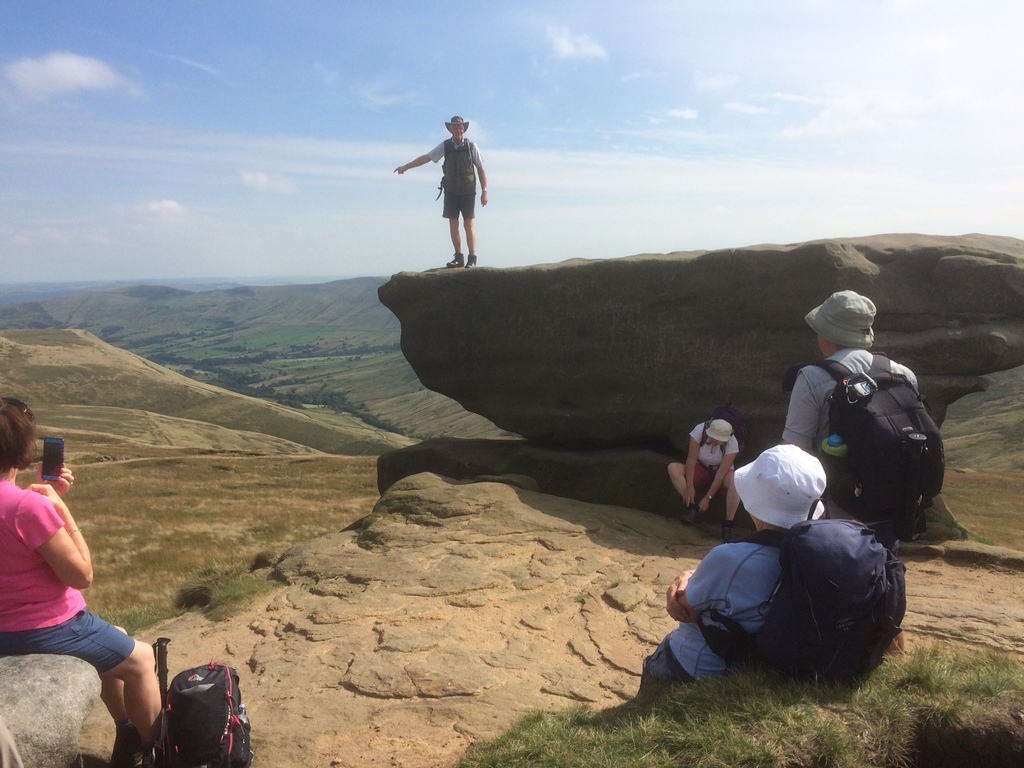
The view from Church Stretton across the A49 is dominated by several high peaks. It was our mission to climb to the top of most of them. We set off confident that the sunshine would continue; the weather forecast said it would and Steve’s app said the clouds had gone for the day. As we climbed the first peak where we were to enjoy a refreshing drink, the clouds changed their plans. The familiar 2016 summer pattern of sunshine and showers continued with frequent stops to add clothing or remove it according to the conditions. Once we made the first peak the leaders revealed that we would stop for lunch on top of Caer Caradoc, the biggest hill near Church Stretton. This is made of volcanic rock that resisted the grinding action of the Ice Age glaciers to be such a prominent feature and is crowned by an Iron Age or late Bronze Age hill fort. It is this which the hill is named after – Caer Caradoc in Welsh meaning Caradog’s fort. Whoever Caradoc was he would have had a good view from his fort. We certainly did while it was sunny.
When the sun shone the views were magnificent. I had time to consider them in some detail as I decided to climb Caer Caradoc by walking straight up; the zigzagging path looked almost as steep as the direct route. Every time the pounding in my ears hit 97 decibels, I turned to view the surrounding countryside. It was lonely when I reached the top but the rest of the party eventually appeared.
One of the great things about the tight-knit group that is the Long Walkers is the help and assistance that members give to one another. As we descended from Caer Caradoc we spotted something reflecting the sunshine back to us and called on Dave to use his binoculars to reveal the nature of the little bright light in the distance. With the aid of his binoculars, Dave announced that it was a big bright light. Technology is such a boon.
From our lunchtime vantage point we could see the golf course that spreads over the hills that overlook Church Stretton. John & Doreen intended to take us down into the valley from Caer Caradoc and up to the golf course before dropping into Church Stretton to return to the cars. Mindful of the further climb and the fact that several walkers were keen to return home before dusk, Doreen put her foot down. As a result of this firm action, the return journey in the drizzle bypassed the golf course and toured Church Stretton downtown instead.
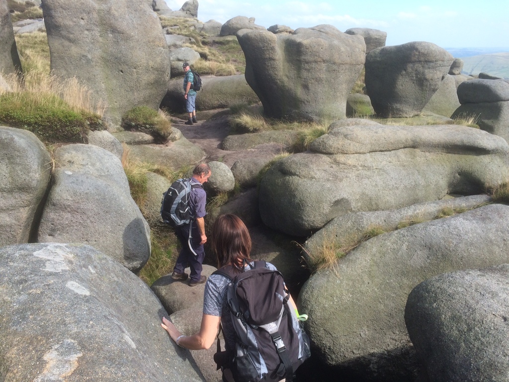
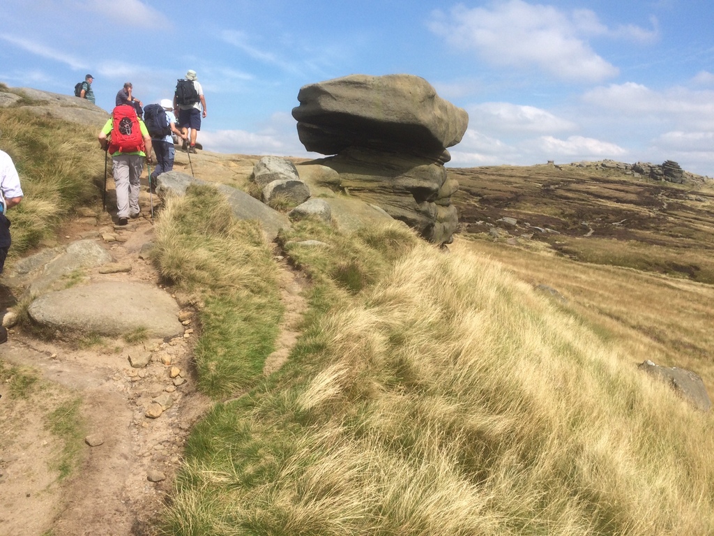
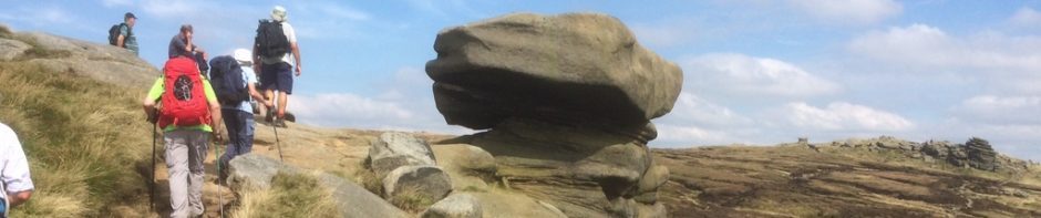
17 Aug Walk Leader: Bill & Ruth Crichton Tideswell to Castleton Drive to start of walk: 36 miles Length of walk: 8.5 miles Number walking: 18
The walk started in Tideswell but we left the cars in Castleton and commandeered a local bus to transport us to the starting point. Since the bus was scheduled to arrive at 11am, we had to find something to do in the intervening hour. Ralph didn’t have the full hour; he had to investigate traffic congestion in Whaley Bridge. It is fortunate that a bakery opposite the Castleton bus station sells bacon butties, pies, cakes and other delights.
Refreshed by this atypical feast we took our seats on the bus which allowed a few spaces for the local old people to join us. What a joy it is to see the elderly still moving about.
Among the passengers that managed to squeeze on were two young girls whose eyes were so pale they should have appeared in a film about alien invasion. Their mother advised us that they were very dirty (strange!) but they just seemed to have lots of scabs (social services?).
Anyway we arrived safely in Tideswell and avoiding any more cake shops we headed for the nearest hill out of town. The weather forecast promised solid sunshine all day, but up to this point, the sky had been filled with clouds. They did disappear though and the promised sun kept us company for the rest of the day.
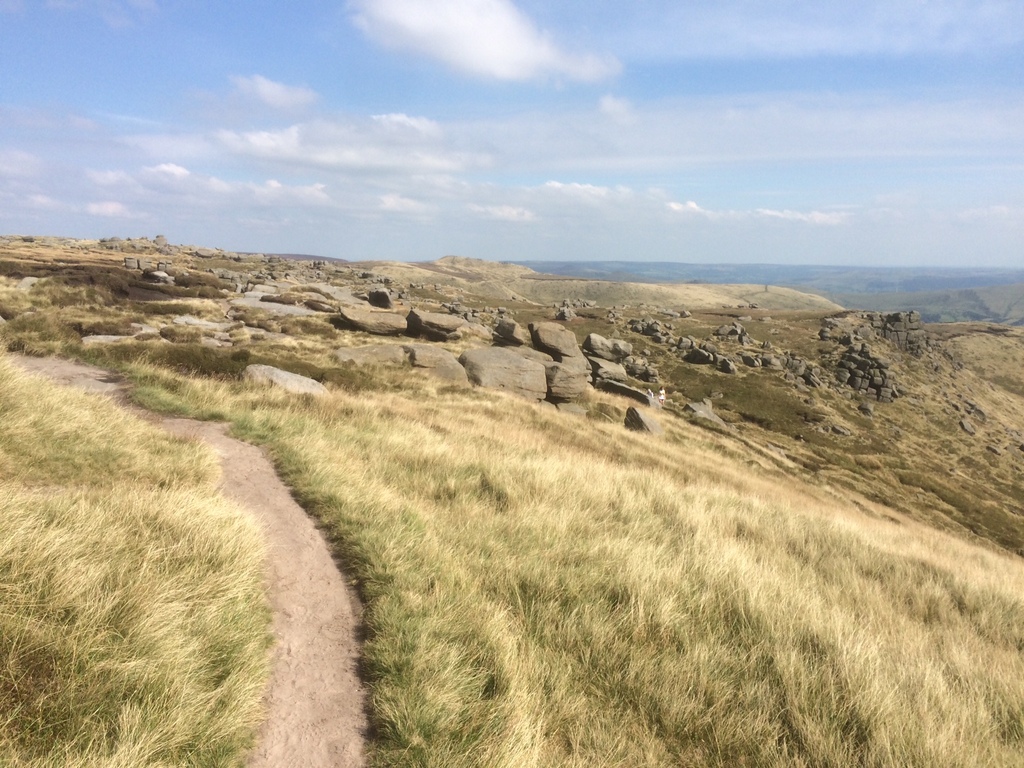
We joined the Limestone Way which took us through Monks Dale, Peter Dale, Hay Dale, and Dam Dale. Somewhere along this collection of dales we sat on a hillside overlooking the path and ate lunch. It was almost perfect; we had sunshine, no wind, there were ledges to sit on and cows bottoms to survey on the hillside opposite. The view could have been better.
We moved from one dale to the next without any sign telling us which we were in. It would have been helpful if one of the ladies had written notes in her diary. It could have been turned into a radio programme.
It was peaceful in the dales but we left Dam Dale and climbed towards the busy A623 road. We had to pass through a field in which a tractor was carrying on the age-old agricultural practice of spreading manure. The tractor left before we arrived, so we didn’t have to dodge the spray. However, the grass was long and the manure was thickly spread. Our boots which had been as clean as when we started, now acquired a patina which dried on firmly.
Walking a stretch of the A623 was more dangerous, but less smelly, so we soon moved onto a footpath from where we had an elevated view over some delightful countryside. We stopped for refreshment on a hillside overlooking a dew pond that provided a fine environment for dragonflies but not clean water for farm animals.
The last stage before we dropped into Cave Dale was notable for the number of walkers accompanied by dogs. None of was attacked on this occasion, so we carefully negotiated the stony path past Peveril Castle into Castleton, where we formed an orderly queue outside an ice-cream shop.
24 Aug Walk Leader: Ralph Browse Edale and Kinder Drive to start of walk: 36 miles Length of walk: 9 miles Number walking: 16
For the first time on a long walk we have to take a train ride so we all rolled up in Edale station car park ready for the short journey to Chinley – just one stop away. The car park was full, which was a shame for the organisation that collects the fees from the machine because that wasn’t working. Now that we were freed from the onerous business of claiming the £2.50 parking back from the train conductor, we set off with light hearts.
Ralph claimed that the most exciting part of the journey would be passing through the Cowburn tunnel, which is clearly shown on the map of the area, but I didn’t see it. Isn’t it exciting to travel on a train?
Once the party was assembled on the platform at Chinley station, Ralph confessed that he had calculated that more than seven miles of the walk involved us climbing up. We have climbed hills many times before and the sun was shining so we set off in a can-do spirit. On the outskirts of Chinley we passed a swing hanging from a sturdy tree but only one member of the party had a go on it. They are so mature.
During the coffee stop we had plenty of opportunity to look around at the familiar landmarks lying below and in the steeper sections of the climb we gave them more detailed examination as we rested our lungs.
As we made our way across the high ground we passed a number of locations which are named on the map but have no signs on them to confirm their identity. These include Jacob’s Ladder, Mount Famine, Brown Knoll and Grindslow Knoll. There was a sign for the Pennine Way and we walked along it for a while.
Eventually we were allowed off the hills and we celebrated in the pub by Edale station. It was a splendid way to finish an excellent walk.